



RouteEye™ for Wildlife & Forest
Using smart AI technology to protect human settlements and wild animals through 24/7 boundary monitoring.
RouteEye™ is an intelligent surveillance network powered entirely by solar energy. It spots wildlife moving toward forest edges, instantly notifies local forest departments, and keeps nearby villages safe from unexpected dangerous encounters.
AI-Powered Wildlife Monitoring Solutions
Animals do not see artificial borders, but human communities live right next to them. RouteEye™ acts as an early warning shield across forest buffer zones, preventing dangerous encounters and supporting peaceful coexistence.
Smart Boundary Monitoring
Wild animals mostly move around at night, in dense brush, or when it is hard to see. RouteEye™ uses rugged, standalone camera poles that run continuously without needing long cables, plugs, or local power lines.
Solar-Powered Vision & Thermal Cameras
Equipped with built-in solar panels and high-efficiency batteries, these cameras keep watching over fence lines and buffer zones without needing any power grid or manual battery swaps.
Round-the-Clock Real-Time Tracking
The system tracks movement continuously 24/7 along vulnerable borders, instantly processing every frame so forest rangers are notified the exact second an animal approaches.
Advanced Low-Light & Night Detection
Because many large predators hunt and roam after dark, high-grade thermal sensors cut through pitch-black darkness, fog, and dense foliage to detect body heat accurately.
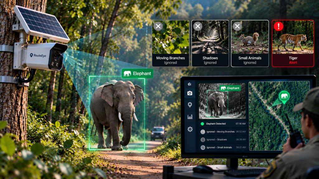
AI-Powered Classification
Advanced computer vision accurately tells the difference between genuine threats and harmless daily forest activity, keeping alert channels reliable.
High-Risk Species Identification
Built-in AI models instantly identify large, dangerous wildlife such as tigers, leopards, elephants, and bears the moment they step into view.
Smart Routine Activity Filtering
The software filters out falling branches, wind-blown grass, cattle, and harmless smaller wildlife so teams do not waste valuable time responding to false alarms.
Continuous Adaptive Learning
The machine learning algorithms consistently update to identify various animals accurately across shifting seasons, rainy conditions, and different landscape terrains.
Instant Danger Alerts & Warning
Fast, multi-channel warnings that trigger right away to give both response units and nearby residents enough time to react safely.
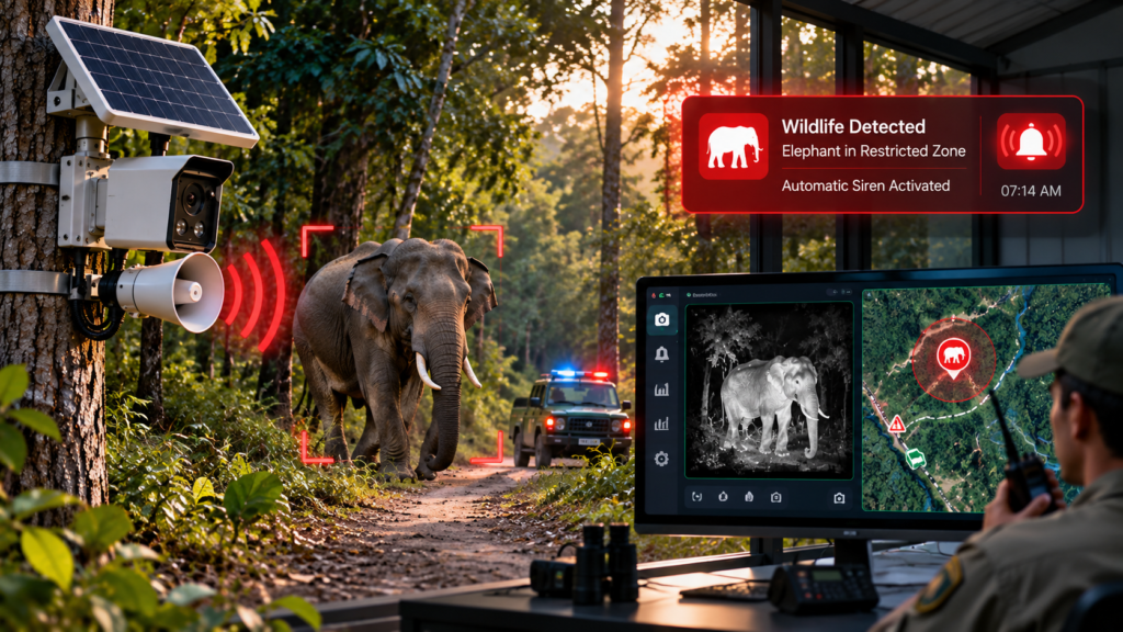
Instant Ranger Notifications
Once an animal crosses a designated perimeter line, real-time alerts with exact GPS locations and photo proof are sent directly to forest rangers on duty.
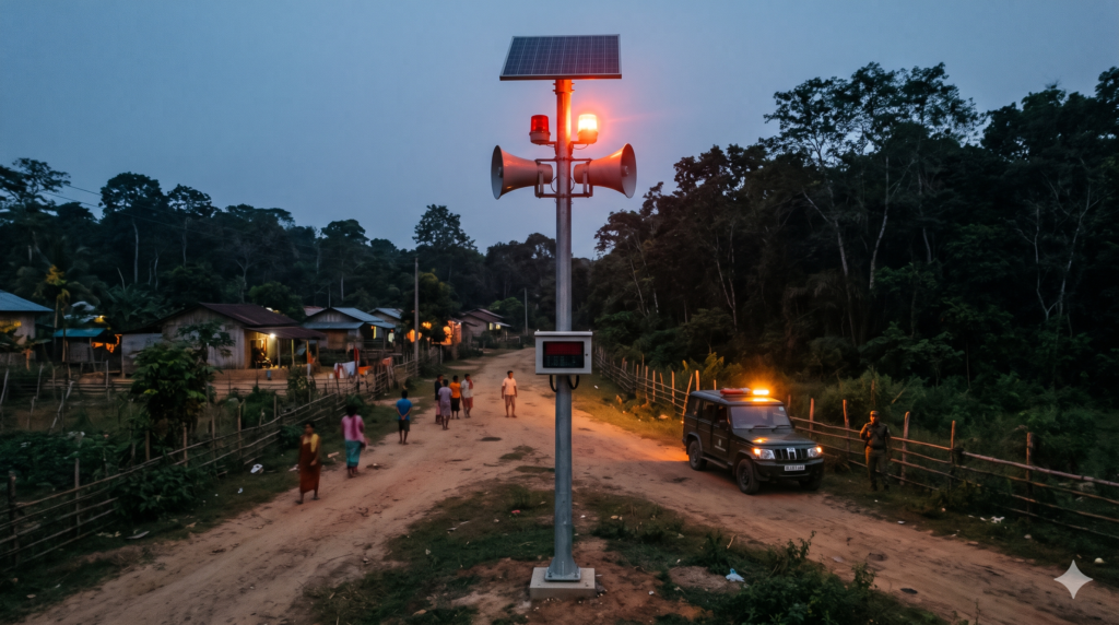
Solar-Powered Community Hooters
Loud, pole-mounted sirens and hooters activate automatically near village entrances to let people know an animal is close and to stay inside.
Strategic Wide-Area Coverage
Warning units are placed along primary entry routes, farm borders, and village paths to ensure warnings reach even the most remote households.
Controlled Warning Signals
Distinct sound and light patterns inform the community clearly about nearby wildlife activity without causing unnecessary panic or chaos.
Reliable Remote Connectivity
Designed to operate reliably in remote forest regions with limited or no cellular connectivity. RouteEye™captures and stores critical tracking data offline, automatically syncing information when the network is restored.
Low-Bandwidth Network Performance
Engineered to run smoothly on weak 2G signals, mesh networks, or low-bandwidth radio channels commonly found in deep forest regions.
Complete Grid Independence
Every sensor and communication unit relies on dedicated solar arrays and internal storage, remaining fully functional even during prolonged power cuts.
Fail-Safe Continuous Operation
Localized offline computing ensures that even if external networks drop completely, local sirens will still trigger when an animal approaches.
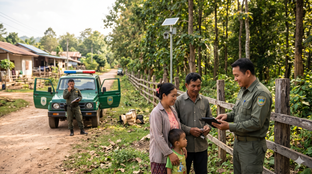
Community Safety & Ranger Support
Giving frontline conservation teams the tools they need while giving villagers the peace of mind they deserve.
Proactive Early Detection
Spotting wildlife while they are still in outer buffer zones gives field teams critical extra minutes to intervene before the animal reaches farmland.
Protecting Lives and Livestock
By preventing sudden confrontations on rural roads and grazing fields, RoutEye saves lives and stops retaliatory attacks against wildlife.
Supporting Peaceful Coexistence
Creates safer boundaries so humans and endangered wildlife can share bordering landscapes safely without constant fear or property damage.
Empowering Field Rangers
Provides patrol officers with exact direction-of-travel maps and live visual updates, allowing them to dispatch response vehicles safely and accurately.
Seamless Field Integration
An all-in-one software and hardware platform linking camera sensors directly to mobile ranger units.
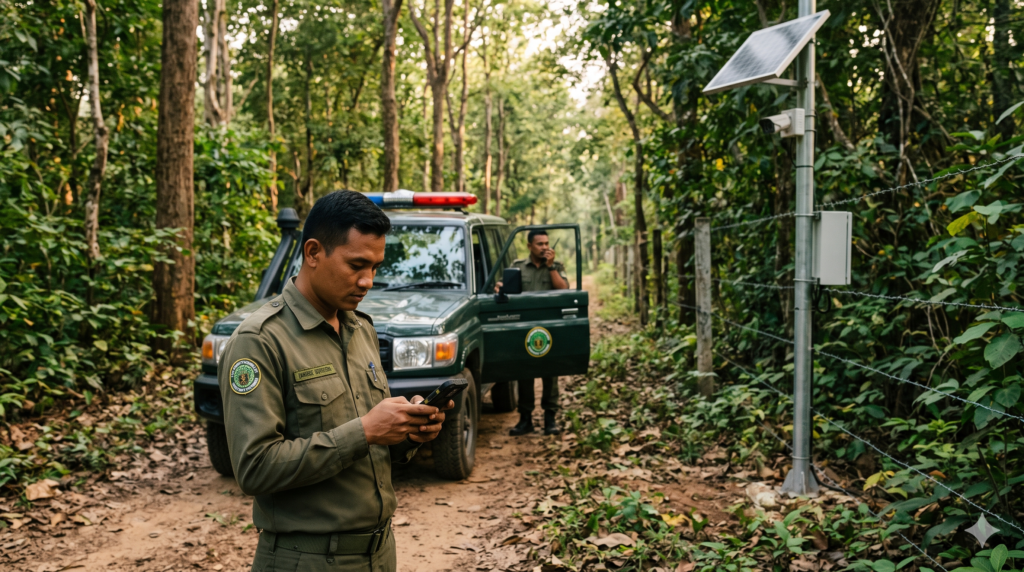
Mobile Dashboard & Push Alarms
Rangers receive straightforward push notifications on their handheld devices showing the species, timestamp, and animal’s current travel path.
Automated Visual & Sound Deterrents
Smart strobe lights and variable sound warnings placed along the perimeter turn on automatically to guide animals back into the forest.
Coordinated Rapid Dispatch
Helps control rooms coordinate quickly with nearest patrol teams, ensuring fast, safe animal guidance away from populated settlements.
Ready to protect your forest borders?
Safeguard wildlife, protect local communities, and eliminate conflict today.
